A new platform out Monday could allow for a global crackdown on plastic waste sites, thereby preventing plastic pollution from entering the oceans.
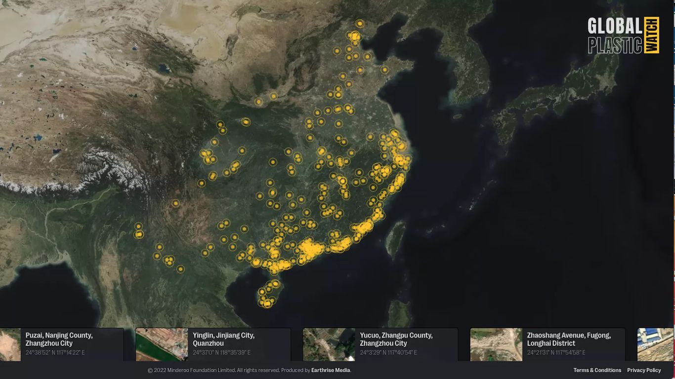
- Global Plastic Watch uses satellite imagery and artificial intelligence techniques to identify likely plastic waste sites in a similar way as space-based imagery is used to locate deforestation hot spots.
Why it matters: By pinpointing sites where land-based waste enters waterways, Global Plastic Watch can allow governments and nonprofits to work to mitigate such pollution. The old adage in environmental protection, that you can’t mitigate what you can’t measure, applies here.
Threat level: The ubiquitous nature of plastic waste threatens the viability of what many oil companies see as a source of future revenue. From the Great Pacific Garbage Patch to microplastics showing up on the highest mountain peaks and deepest oceans, reducing the amount of plastic waste could have significant benefits.
Zoom in: Global Plastic Watch is a project funded by the Australia-based Minderoo Foundation. It has already revealed numerous, previously undocumented large-scale waste sites across 24 countries mapped so far, according to Fabien Laurier, who leads technology and innovation for the foundation.
- The tool, whose interface resembles maps tracking other environmental problems, from wildfires to carbon dioxide emissions, provides for the possibility of partnerships with governments that are contributing a significant amount of land-based plastic waste.
- One such country, Indonesia, is already using the technology to find undocumented or illegal waste sites, according to a Minderoo Foundation statement.
What they’re saying: “Plastic pollution on land contributes to more than 90% of plastics getting into the ocean,” Laurier told Axios in an interview.
- “But up until now, the scientific understanding and waste management, in general, has been relying on estimates and models that are most often than not inconsistent, sometimes even inaccurate.”
- “The goal here was to make sure that we would know where the plastic on land, provide the data to governments so they can better manage it, and stop it from entering rivers and the oceans in the first place,” Laurier said.
The big picture: The new tracking tool is similar in concept to other projects launched in the past few years, such as Global Fishing Watch and Flaring Monitor, which keeps tabs on natural gas flaring.
- It takes advantage of publicly available data from the European Space Agency’s Sentinel satellite constellation and AI-driven data analysis to provide real-time monitoring capabilities.